 Shop By Category
- Pantry Staples
- Canned, Jarred & Packaged Foods
- Condiments & Salad Dressings
- Cooking & Baking Grocery Supplies
- Dried Beans, Lentils & Peas
- Dried Grains & Rice
- Herbs, Spices & Seasonings
- Jams, Jellies & Sweet Spreads
- Nut & Seed Butters
- Olives, Pickles & Relishes
- Pasta & Noodles
- Sauces, Gravies & Marinades
- Soups, Stocks & Broths
- Gardening & Lawn Care
- Composting & Yard Waste Bins
- Fertilizer Spreaders
- Garden Sculptures & Statues
- Gloves & Protective Gear
- Greenhouses & Accessories
- Indoor Gardening & Hydroponics
- Lawn & Mulch Paint
- Outdoor Carts
- Plant Covers
- Plant Support Structures
- Pots, Planters & Container Accessories
- Sprayers & Accessories
- Water Gardens & Ponds
- Watering Equipment
- Weed & Moss Control
- Children's Books
- Action & Adventure
- Activities, Crafts & Games
- Animals
- Arts, Music & Photography
- Biographies
- Cars, Trains & Things That Go
- Children's Cookbooks
- Classics
- Comics & Graphic Novels
- Computers & Technology
- Early Learning
- Education & Reference
- Fairy Tales, Folk Tales & Myths
- Geography & Cultures
- Growing Up & Facts of Life
- History
- Holidays & Celebrations
- Humor
- Mysteries & Detectives
- Religions
- Science Fiction & Fantasy
- Science, Nature & How It Works
- Sports & Outdoors

- Delivery
- Price Range
- Brands
- Categories
- Normal delivery
- Express Delivery
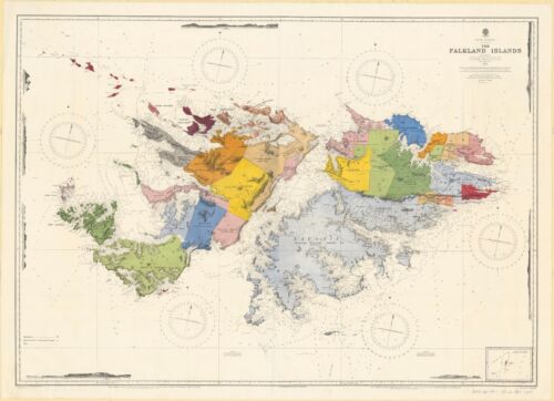
Buy Ordnance Survey Products Online at Best Prices | Ubuy Pakistan
Discover the beauty and details of Pakistan with Ordnance Survey, the renowned mapping agency that has been providing accurate and detailed maps of Great Britain since 1791. Explore their extensive collection of maps and related products for navigation, planning, and outdoor activities. Read More


![U.S. Geological Survey water-supply paper Volume no.2220 2004 2004 [Leather Bound]](https://i5.walmartimages.com/asr/126fe2ce-e84e-4cb0-bfbc-c1951507e615.6f747377a0fafcc5c3d7d5613f0ca42d.jpeg?odnHeight=180&odnWidth=180&odnBg=ffffff)

![Quality-assurance/quality-control manual for collection and analysis of water-quality data in the Ohio District, U.S. Geological Survey / by D.S. Francy ... [et al. [Leather Bound]](https://i5.walmartimages.com/asr/114cf678-b04d-4ba8-829f-ed246b586d10.c2180e62998364a10c96e6e3b1a03b7c.jpeg?odnHeight=180&odnWidth=180&odnBg=ffffff)

![Geological Survey bulletin. Volume no.23 1885 (1885) [Leatherbound]](https://i5.walmartimages.com/asr/b637a149-20aa-49f7-bce3-4c9eace39f48.ef74425ac348d6049b883a8c4c37002b.jpeg?odnHeight=180&odnWidth=180&odnBg=ffffff)

![North Carolina Geological and Economic Survey, 1911-1912 (1912) Volume 1911-1912 [Leather Bound]](https://i5.walmartimages.com/asr/0f77918c-139b-49e2-9252-f58bbc2ef74c.66399efee35c31b713df30dc31c8e6d0.jpeg?odnHeight=180&odnWidth=180&odnBg=ffffff)


![On the Need of a Topographical Survey of the Dominion of Canada; On a New Nepheline Rock From the Province of Ontario, Canada [microform] (Paperback)](https://i5.walmartimages.com/asr/3474854c-49b9-4001-94b4-11ee2e69ad4f.b9c4dfabcb556e9d8e35f712951502c5.jpeg?odnHeight=180&odnWidth=180&odnBg=ffffff)


- 1
- 2
- 3
- 4
- 5
- 6
Explore About Ordnance Survey & Its Products
Ordnance Survey is a UK-based mapping agency that produces maps and digital mapping services with a focus on high-quality and up-to-date cartography. The brand has been in operation for over 200 years, providing maps to government, businesses, and individuals across the United Kingdom.
Founded in 1791 by the British government to produce military maps of Scotland
Expanded to cover all of Great Britain by the mid-19th century
Introduced grid references and contours to its maps in the early 20th century
Has continued to innovate with digital mapping services, including OS Maps and OS OpenData
Brands Similar to Ordnance Survey
Google Maps
A digital mapping service that provides global coverage and offers satellite imagery, 3D mapping, and street views.
Bing Maps
A web mapping service offered by Microsoft that provides driving directions, traffic information, and satellite imagery.
TomTom
A Dutch company that provides mapping and navigation products for personal and business use, including GPS devices and automotive navigation systems.
Top Trending & High Rated Products of Ordnance Survey
OS Maps
Ordnance Survey's online mapping service, offering detailed maps and route planning tools for hiking, cycling, and other outdoor activities.
OS OpenData
Ordnance Survey's open data initiative, providing free access to a wide range of mapping data for personal, educational, and commercial use.
Custom Made Maps
Ordnance Survey's tool that allows users to create custom maps, choosing the scale, area, and cover material.
Common Questions Asked by Customers About Ordnance Survey & Its Products
How accurate are Ordnance Survey Maps?
Ordnance Survey maps are highly accurate and regularly updated to reflect changes to the landscape. They use a variety of sources, including aerial photography and ground surveys, to ensure their maps are up-to-date and reliable.
Can I use Ordnance Survey maps for navigation?
Yes, Ordnance Survey maps are widely used for navigation by hikers, cyclists, and other outdoor enthusiasts. The maps include a grid reference system and scale indicators, making it easy to plan and follow routes.
What is OS OpenData?
OS OpenData is Ordnance Survey's initiative to provide free access to a wide range of mapping data for personal, educational, and commercial use. The data covers everything from street maps to aerial imagery, and can be used for a variety of purposes.
Can I print Ordnance Survey maps?
Yes, Ordnance Survey maps can be printed from the OS Maps website or using third-party printing services. Printed maps can be useful for planning routes and taking offline backup.
How do I update my Ordnance Survey map?
Ordnance Survey maps are updated regularly with changes to the landscape. To ensure that you have the most up-to-date map, you should check for updates regularly or subscribe to the OS Maps service for automatic updates.
Quick Links
Payment
 Paypal
 Visa
Visa Mastercard
Shipping

Express ShippingFast Delivery

Standard Shipping10+ Business Days
Cities Covered
Other
Download our App

